Mapping Africa Transformations

Climate
MAPTA-Climate enables users to track the sustainability and resilience of African urban agglomerations. It combines new and innovative spatial data on green spaces, pollution, street networks, and urban forms for nearly 7 200 urban agglomerations with 10 000 inhabitants and above in 54 countries. This data improves our understanding of functional environmental realities and identifies current and future vulnerabilities as well as levers of action for transformative change.
African cities are important places to focus climate action. They are considered “extremely at risk” by the Climate Change Vulnerability Index and therefore need data and decision-making tools. In the context of rapid urbanization, better planning toward a more sustainable, compact urban form is critical.
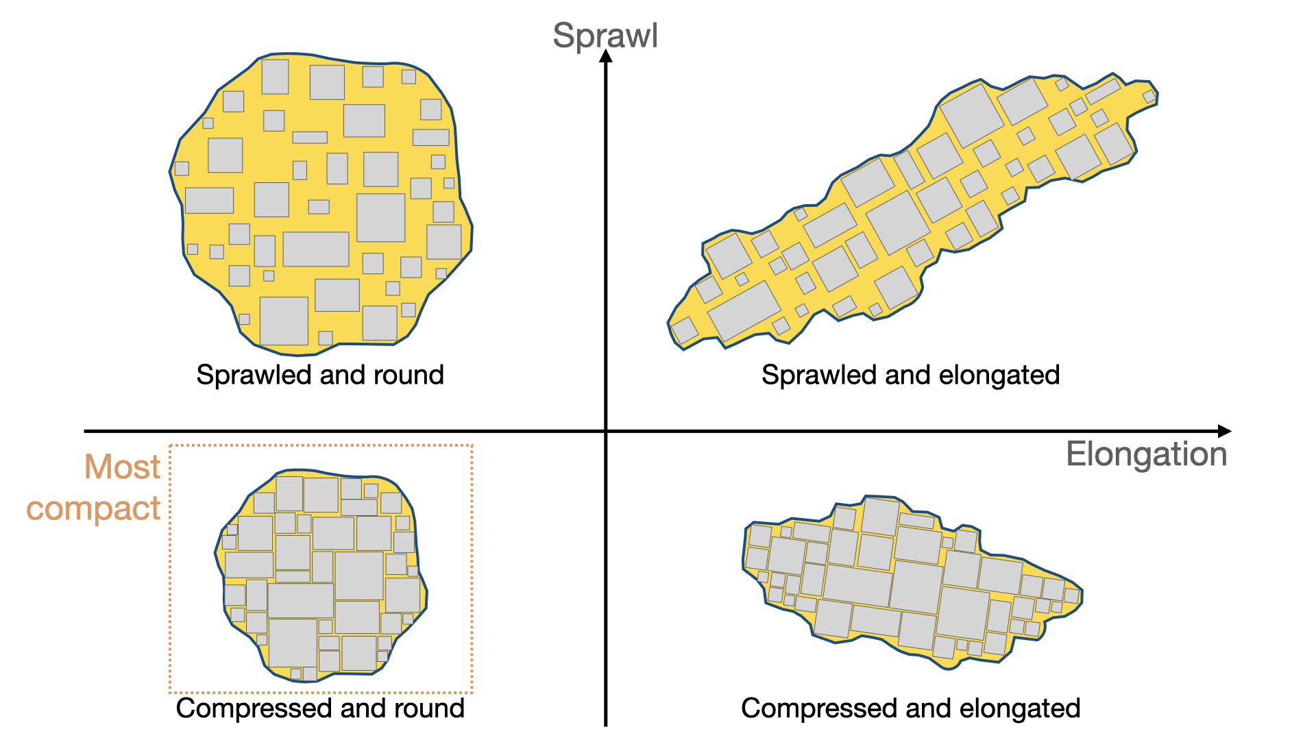
A more compact city means better access to services, less travel, less energy consumption by vehicles, and therefore less emissions and pollution. To measure compactness, SWAC developed two indicators for 5,625 African urban agglomerations: sprawl and elongation.
Measuring urban compactness
Firstly, sprawl measures the amount of space between buildings. A value of 1 means that the agglomeration is compact, > 1 indicates increasing sprawl. Secondly, elongation measures the tendency of the buildings to form a circle, which is the most compact urban form. A value of 1 means that the agglomeration is a circle. Higher values indicate that the shape becomes more elliptical.
The most compact city has a round shape with short distances between buildings. The least compact has greater distances between buildings and mode elongation.
Mapping urban form in Africa
Diversity of African urban forms
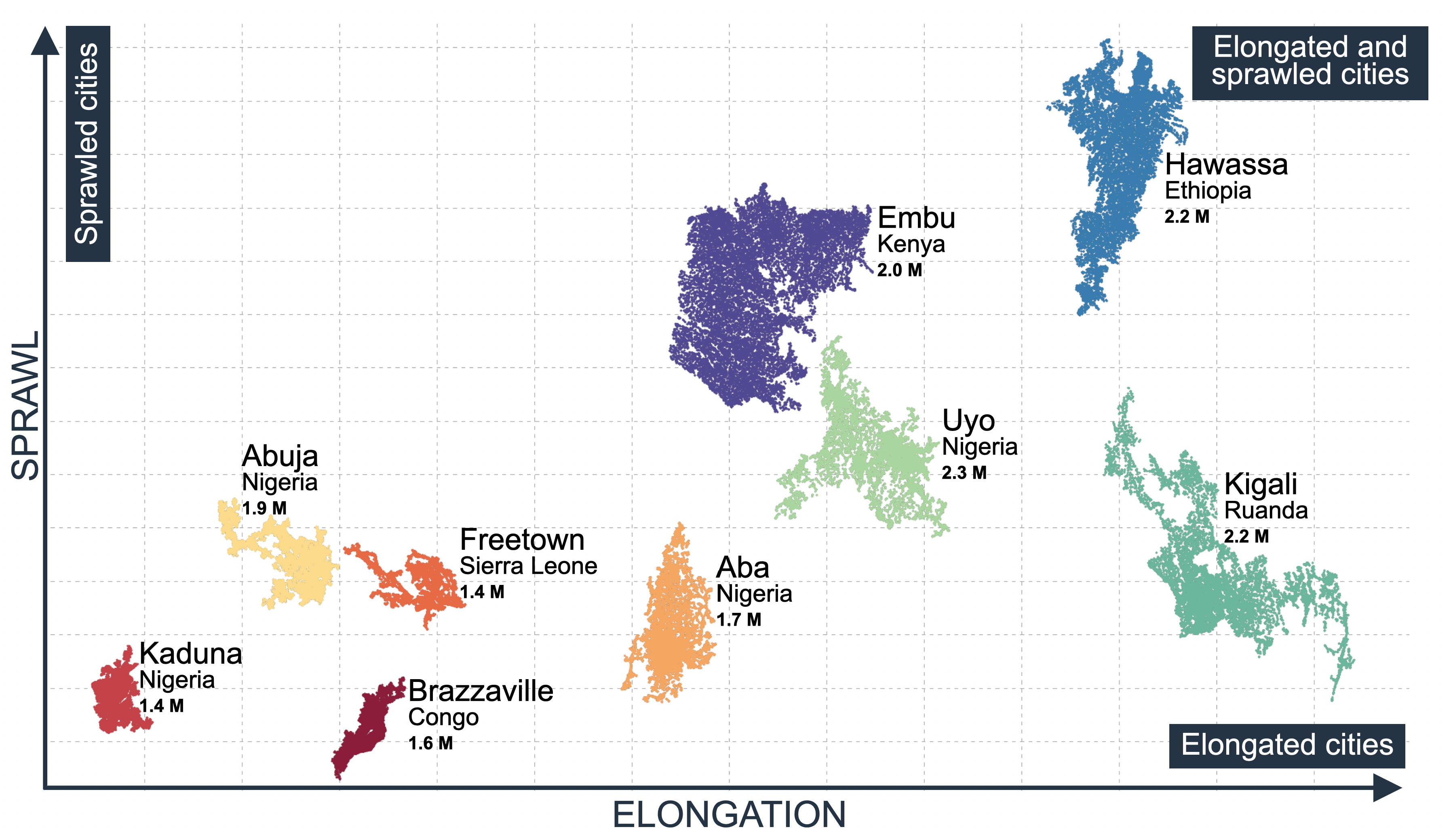
The built environment across cities varies according to location within a country as well as city size. Two trends have emerged. First, very large cities (above 4 million inhabitants) are more compact than large and intermediate ones. Second, sprawl and elongation increase with the city size up to 4 million people. This is because very large cities fill in the space between buildings and start to become more circular, reducing distances. Below are some examples of cities with similar population sizes but different degrees of sprawl and elongation.
Data sources
Two data sources are combined. SWAC/Africapolis defines urban agglomerations using two criteria: i) an area with 10,000 or more inhabitants and ii) a continuously built-up area with less than 200 meters between buildings. Open Buildings provides the location and size of the footprint of the buildings. Other indicators displayed in the map pop-up combine Africapolis with OpenStreetMap and building height data from the German Aerospace Center (DLR). For a detailed description of the calculation of these indicators, please consult this document.
Citation:
OECD/SWAC (2023), “Urban Form Dataset”, Mapping Territorial Transformations in Africa (MAPTA), https://mapping-africa-transformations.org/climate (accessed on DD-MM-YYYY).