
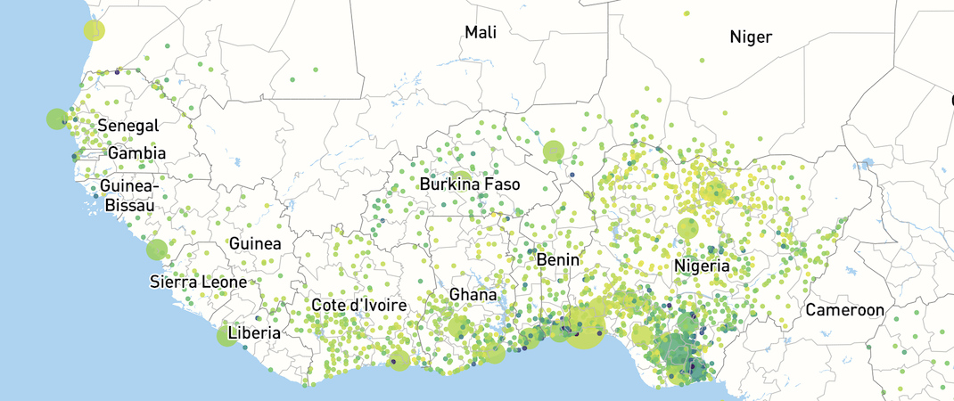
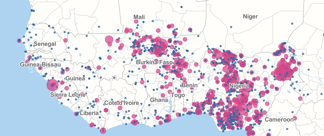
Security
Instablity has been growing in the Sahel and West Africa as transnational violent extremist organisations have proliferated. As a result, violent events have become more frequent and civilian casualties have increased. Our tools help policy makers to better understand the spatial dynamics of violence which leads to better designed, place-based and contextualised policies.
Security
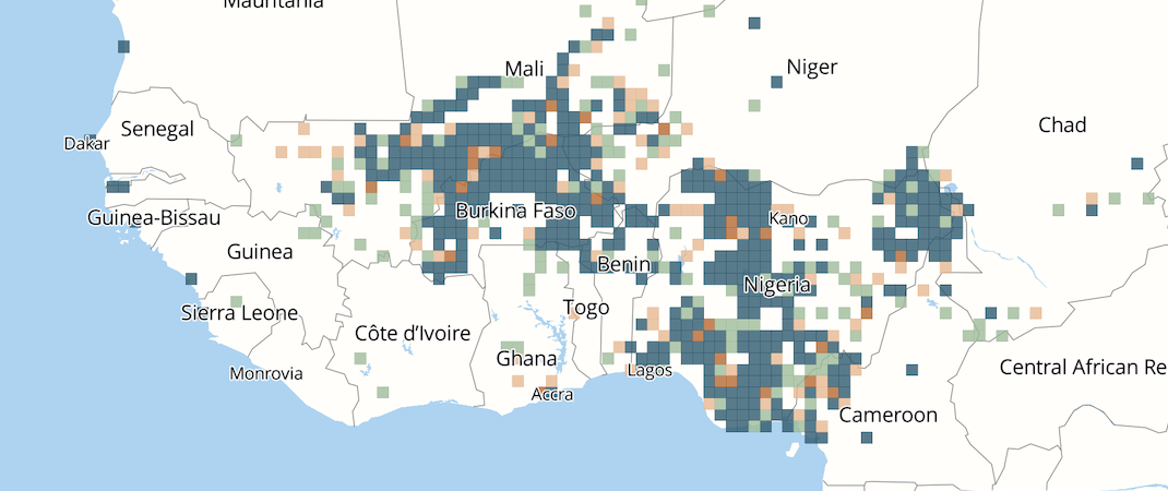
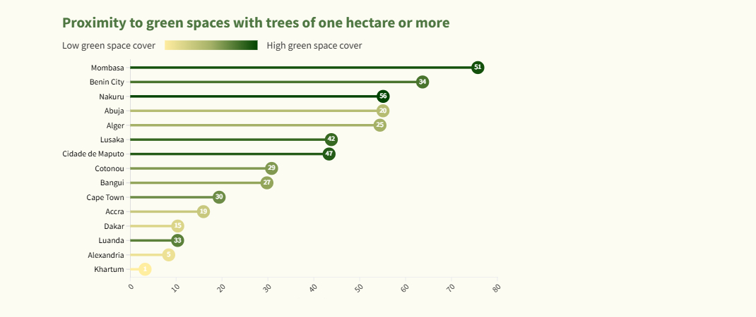
Climate
MAPTA-Climate enables users to track the sustainability and resilience of African urban agglomerations. It combines new and innovative spatial data on green spaces, pollution, street networks, and urban forms for nearly 7 200 urban agglomerations with 10 000 inhabitants and above in 54 countries. This data improves our understanding of functional environmental realities and identifies current and future vulnerabilities as well as levers of action for transformative change.
Climate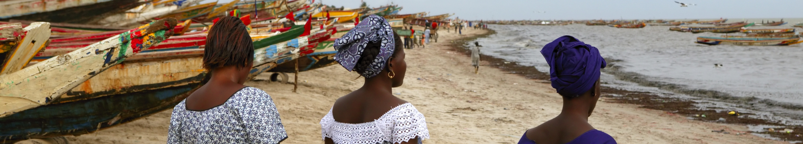
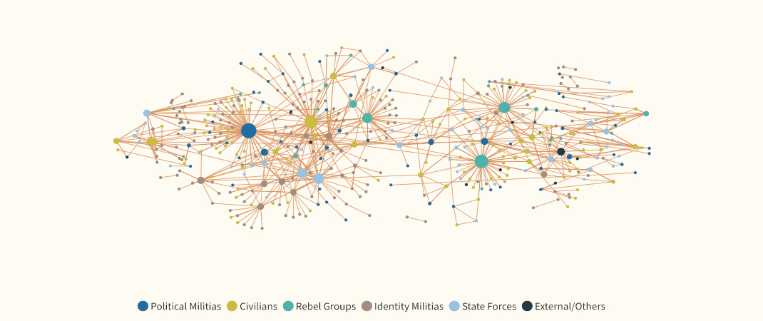
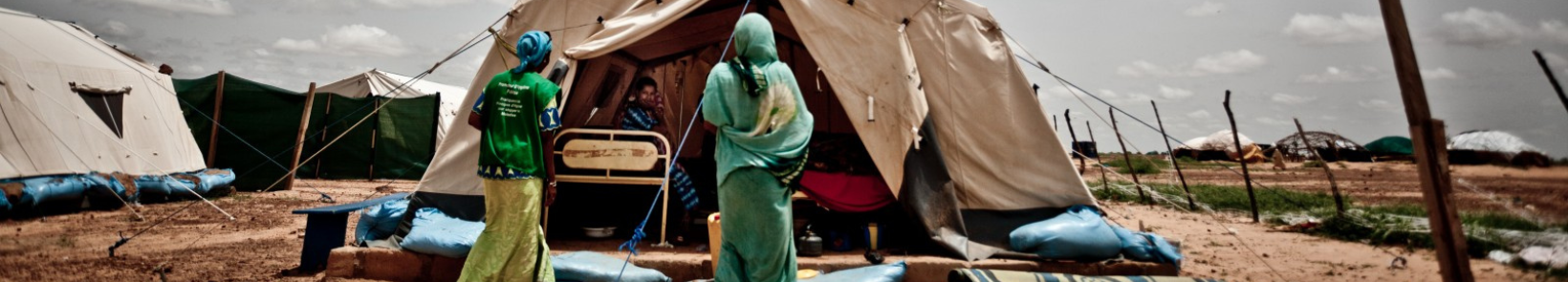
Gender
In conflict-affected areas, gender inequalities are exacerbated. Women and girls experience different forms of violence in addition to structural discrimination against their political representation and economic and social empowerment. They are deliberately targeted by Islamist organisations and militias and are victims of government forces during counter-insurgency operations. Within communities, they are also exposed to violence related to the sharing of water, land, and other resources.
Gender